Introduction to the archaeological ruins of Monte Albán, Oaxaca
This spectacular example of urban development in Mesoamerica was founded in about 500-450 BCE, and, by the end of what archaeologists call Monte Albán I (500-100 BCE), was a large economic, political, and religious center with about 17,000 inhabitants. By its "Golden Age" (100-600 CE) the city grew to cover 6.5 square kilometers (2.5 square miles) with a population of about 25,000. Andrew Coe explains during this time period "the hillside below the ceremonial center was covered with more than 2,000 terraces for houses and farm plots, and the valley below held an estimated population of 100,000" (210). This was the Zapotec capital city located on a mountain about 1300 feet above the valley floor and at the juncture of three valleys of central Oaxaca. It replaced San José Mogote as the power center of the valley, even though it was somewhat remote and had no natural source of water. It did have a magnificent view of the valley (See photo of the view today) although no doubt its strategic value was more significant. This large site has been studied intensely and a well-developed chronology has resulted.
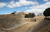
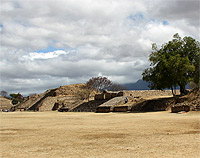
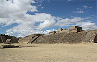
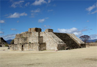
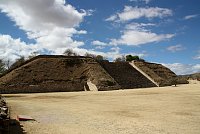
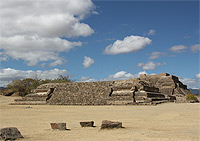
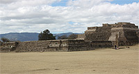
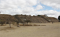
The acropolis was partly manmade. The mountain had been artificially flattened with a few rock outcrops serving as foundations for some of the buildings and the soil from the leveling process serving as fill for other buildings. Today, of course, the perishable superstructures are gone. The typical building structure includes a stone-faced platform with a frontal stairway with flanking balustrades. The buildings were originally stuccoed and apparently some had painted decoration. Specific buildings are discussed in the pages that follow.
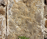
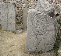
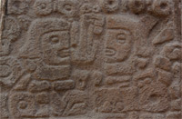
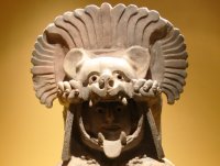
About 170 tombs have been discovered, some with several chambers and some with murals and decorative artifacts, especially ceramic effigies. These magnificent tombs indicate that the rulers of Monte Albán were wealthy and powerful; the offerings in the tombs show evidence of trade with natives to the south in Chiapas and with the growing city to the north at Teotihuacan (Coe 210). Unfortunately, these tombs are not open to the general public.
Around 800 CE the city declined as the population moved away and the focus of culture moved to other areas. Monte Albán fell into ruins. Eventually, it became largely a necropolis where Mixtec rulers buried their own. (The famous tomb treasures of Tomb 7 are Mixtec, not Zapotec, and from this much later period.)
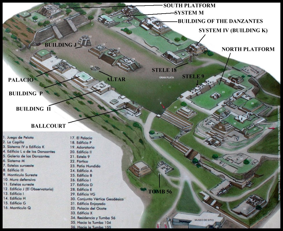
Map of the Site--a photo of signage on site with my additions
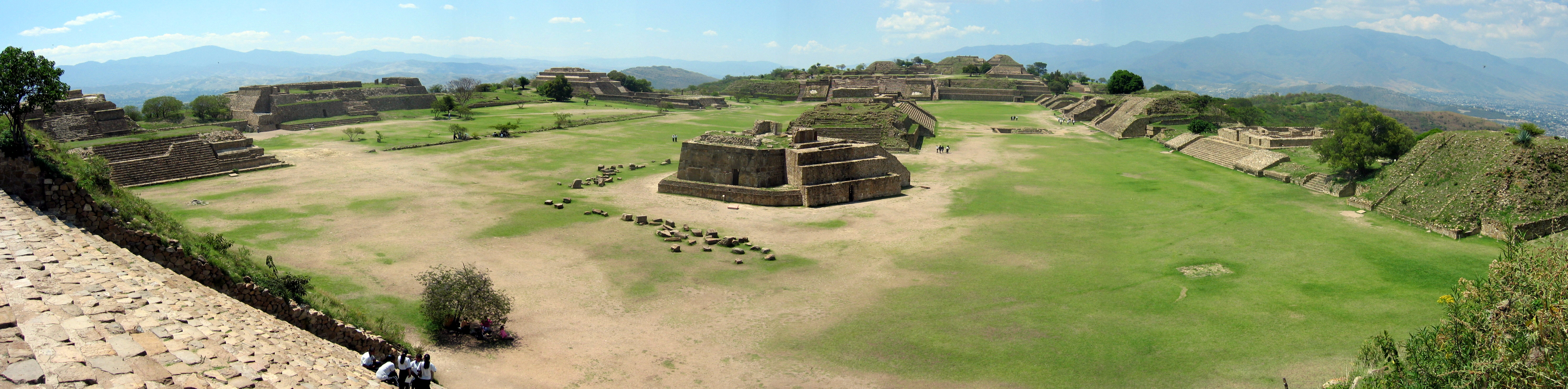
As it developed in the Classic period (Monte Albán period III), the site had roughly bilateral symmetry with an axis running from north to south and with the long, large Grand Plaza in the center. This plaza was paved with white stucco. Miller explains that the architecture reflects "an attention to the natural topography of the surrounding valleys" difficult to discern today or in photographs. She claims the "cadence of elevation to depression in the manmade structures on the west side of the plaza . . . so precisely repeats the rhythm established by the western range of mountains that the Monte Albán acropolis becomes a microcosmic replica of the surrounding valley of central Oaxaca" (83-4). She also points out that the site is somewhat enclosed with structures on the east in particular being almost contiguous and with corners being closed as well. This gives the ceremonial core a private character.
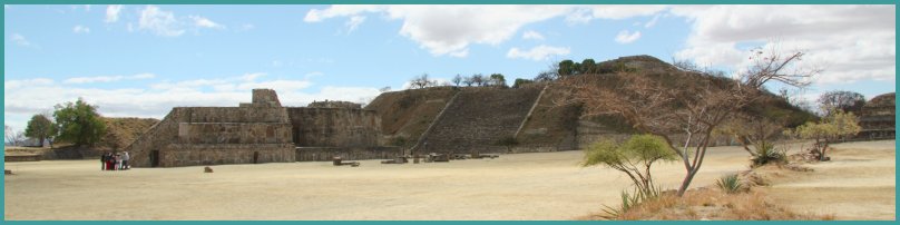
See also this panoramic view of the site taken from the south platform; the image is on wikipedia and photographed by Hashashin.
Index to the Images of the archaeological ruins of Monte Albán
200 images
Works consulted or quoted:
Andrew Coe. Archaeological Mexico. Emeryville, CA: Avalon Travel Publishing, 2001.
Michael D. Coe and Rex Koontz. Mexico: From the Olmecs to the Aztecs. Fifth Edition. London: Thames & Hudson, 2002.
Nelly M. Robles Garcia. Monte Albán: History, Art, Monuments. Mexico: Monclem Ediciones, 2004. [official guide]
INAH. Signage at the site.
Mary Ellen Miller. The Art of Mesoamerica: From Olmec to Aztec. Third Edition. London: Thames and Hudson, 2001.
 Go to the Mexico Index.
 Click here to return to index of art historical sites.
Click here to return to index of artists and architects.
Click here to return to chronological index.
 Click here to see the home page of Bluffton College.
© 2009 Mary Ann Sullivan.
I have photographed (on site), scanned, and manipulated all the images on these pages. Please feel free to use them for personal or educational purposes. They are not available for commercial purposes.

